Mobile Apps and Useful Tips to Protect Your Drone From Crashes or Minimize the Harm
Table of contents
- Apps for drones: a brief overview of the top 5 applications
- Airmap
- B4UFly
- Hover
- Airnest
- UAV Forecast
- Why do drones crash or how can you protect your digital friend?
- Malfunctioning rotors
- No GPS signal
- Compass error
- Disconnected video transmission
- Hitting return to home too soon
- Incorrect home point
- Power failure
- Insufficient battery to return home safely
- Crashing into another drone
- Mistaking the direction of the aircraft
- Want to ensure extra protection for your investments in a drone? Consider using drone insurance estimators
- Verifly
- SkyWatch AI Drone Insurance Pro
Regardless of the cause of purchasing a drone, every owner wants to ensure its long service. Fortunately, there are various mobile applications a drone owner can use to establish a better connection with the device and enhance the experience of using it.
In this post, we are going to provide you with a brief overview of the best apps for drones and offer some useful advice on the measures that can protect it from crashing or allow you to get some refund in case something unforeseen happens.
Apps for drones: a brief overview of the top 5 applications
Having a drone is a nice thing, but piloting is not as easy as it may seem first. There are numerous factors beyond the owner’s skills that have a strong impact on the flight. These could be visibility, wind, location, etc. So to ensure the best possible drone piloting experience, owners can take advantage of the following applications:
Airmap
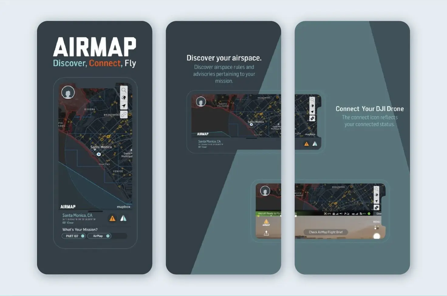
If you are looking for an app for drones that is much more than a map to navigate it, and offers more professional than the amateur experience of piloting, then Airmap is the solution for you. The product is supported by Microsoft, Qualcomm, and a famous drone player Yuneec - all contributing to its commercial success. While some of its commercial features may seem too much for a laid-back, hobby flight on a sunny weekend, whether we are talking about drone mapping, geo-fencing, or flight logging, all of them actually provide you with such valuable things as real-time traffic alerts.
B4UFly
Тo matter how you might plan a perfect flight, there's always a possibility of a hitch, especially when it comes to the established by FAA drone laws. So if you consider yourself as an upstanding citizen with a drone, the B4UFly app will help you. The app tells you where and when you can fly with unfailing accuracy.
Hover
If you want to have an app at hand that will provide you with a range of different features, combining the essentials of those solutions you can use for a great drone flight together, consider trying Hover. The same as Airmap, this product provides location awareness but also offers you info on the weather (visibility, wind, etc.), becoming your solid bet.
Airnest
Airnest is probably one of the most user-friendly apps for drone owners you can find. In a sharp and highly intuitive environment offered by the app, a user can access such useful features as pre-flight planning, waypoints and points of focus. But together with simplicity in use, the app also offers some unique and demanded features, and here are some of them:
- You can draw a route for your drone with a finger, adding points of interest with pins on the map.
- There is a ‘Motion Camera’ feature, which allows you to control your drone’s camera just by panning and tilting the connected iOS device.
- There is the ‘Plan’ mode, which has been likened to the “Photoshop of flight planning”.
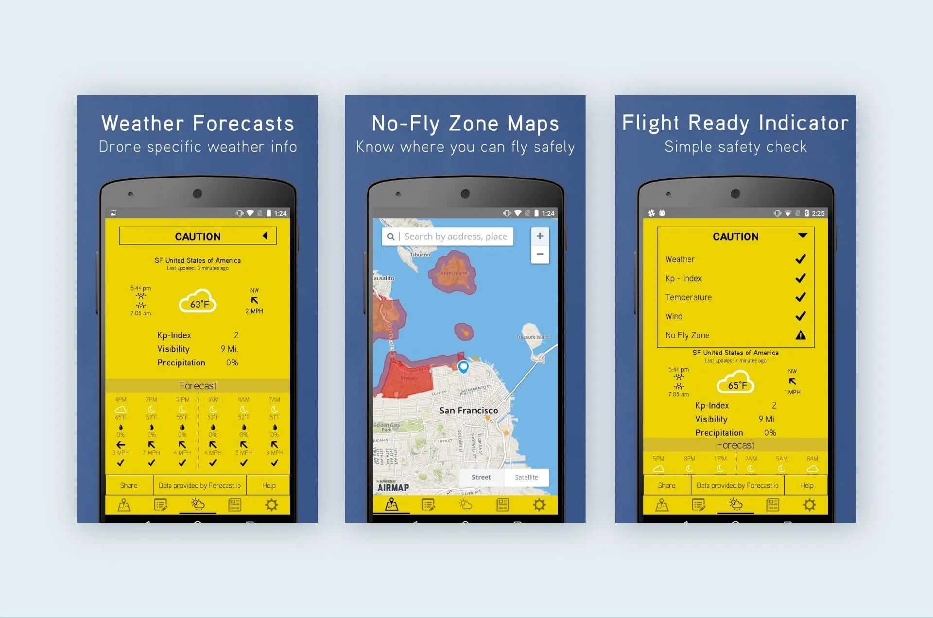
UAV Forecast
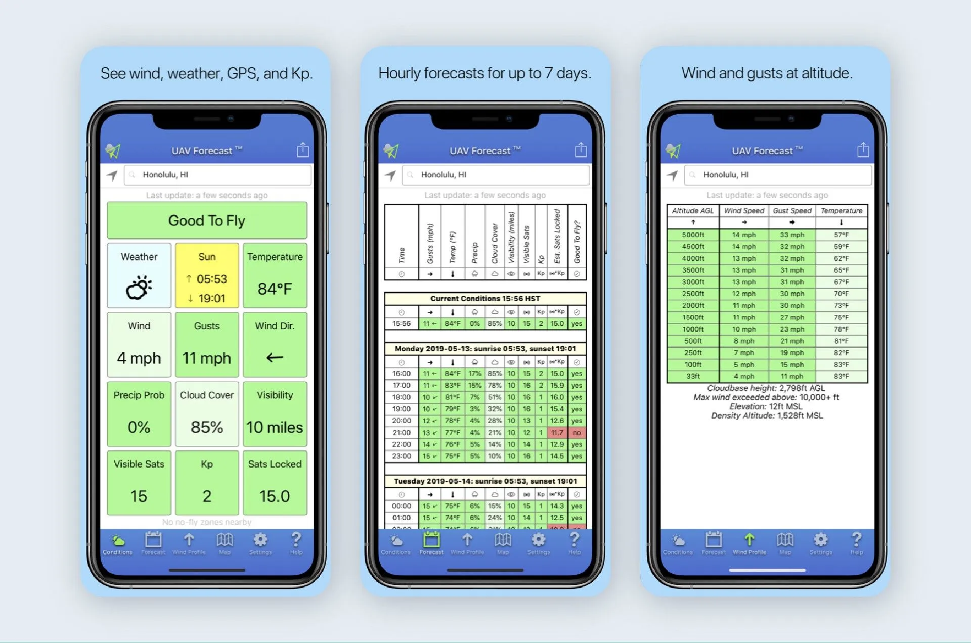
While UAV Forecast is entirely focused on weather, the forecasts produced are tailored to specific parameters of your drone, telling you if it’s safe to fly. But that’s not all: users of the app receive a wide range of useful information that ensures easy and joyful flight: wind speed and direction, wind chill and temperature, cloud cover, visibility, and more. And, what’s also important, the app features mapping with visible no-fly zones.
Why do drones crash or how can you protect your digital friend?
It’s true that there are numerous apps that can tell you if it’s safe or not to fly, can show you the best and the most breathtaking areas to pilot your drone, and provide you with useful information on the go. But there are also things you can do yourself to ensure a safe flight. To help you with this, we provide 10 key reasons why drones crash, so you can check your device before the flight.
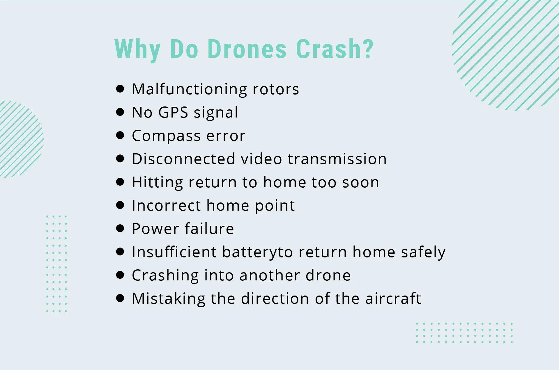
Malfunctioning rotors
The rotors (propellers) of your drone are designed not to hurt people and objects, so they are pretty soft. It means that after several bumps they can get out of shape and it's important for a drone owner to check them before each flight.
No GPS signal
Cases when your drone can’t get a GPS signal are mostly caused by the fact of piloting indoors or nearby tall buildings. To prevent such situations, always choose open areas for your flights.
Compass error
What can cause a compass error - one of the main reasons for a drone crash? These could be anything containing magnets (for example car speakers in your car) or flights close to environments with high electromagnetic interference (high voltage power lines or cell phone towers).
Disconnected video transmission
Your drone can lose video transmission when cable ports are damaged or loose. To prevent such cases, it is recommended to check if cables are well plugged before the flight. Also, make sure to unplug them carefully right after the flight. Such easy maintenance procedures will allow you to keep cables in a good shape and minimize the possibility of your drone crashing due to the problems with video transmission.
Hitting return to home too soon
While the Return to Home (RTH) button is often considered by drone owners as an emergency one, often used when a pilot loses control of the devices, the truth is that when you press it too soon, when your drone is away from you, it can actually lead to a crash. The thing is that in such a mode, your drone doesn’t avoid obstacles, which means that in case there’s a tree or some other object on its straightway to home, the possibility of a crash is close to 100%.
Incorrect home point
There are cases when the GPS lock gets lost during the flight, so the home point changes when GPS regains. Note that in such a case it could be where you took off or where your remote controller is.
Power failure
Before the flight, always make sure that your battery is fully (or completely fully) charged because there are cases when your drone may lose power when you don’t expect it, even if the flight began with a mid-charged battery.
Insufficient battery to return home safely
This point derives from the previous one. Your drone needs at least 30% charged battery to return home safely, giving you time to find a good spot for landing or find a solution in case of emergency. Note that when the battery is 10%, the drone will automatically set a course to the home point, so there should be no trees or other obstacles on its way.
Crashing into another drone
While in most cases, you can avoid such situations by using an app showing other drones (if they are registered), it’s still recommended to avoid flights in areas crowded with people but if you do, at least do not perform complex maneuvers.
Mistaking the direction of the aircraft
This tip is essential for beginners because there are cases when a drone can crash due to a pilot’s mistake in which side is which. So before flying high up in the sky, make sure to familiarize yourself with the drone.
Want to ensure extra protection for your investments in a drone? Consider using drone insurance estimators
Unfortunately, there’s no app that can give you a 100% guarantee that your drone won’t crash. Also, sometimes the owner’s piloting skills and preventive measures taken are not enough, so it’s wise to ensure extra protection that will allow you to get some refund in case of a crash. For such purposes, a drone pilot can take advantage of drone insurance estimators. Here are a few examples of such apps:
Verifly
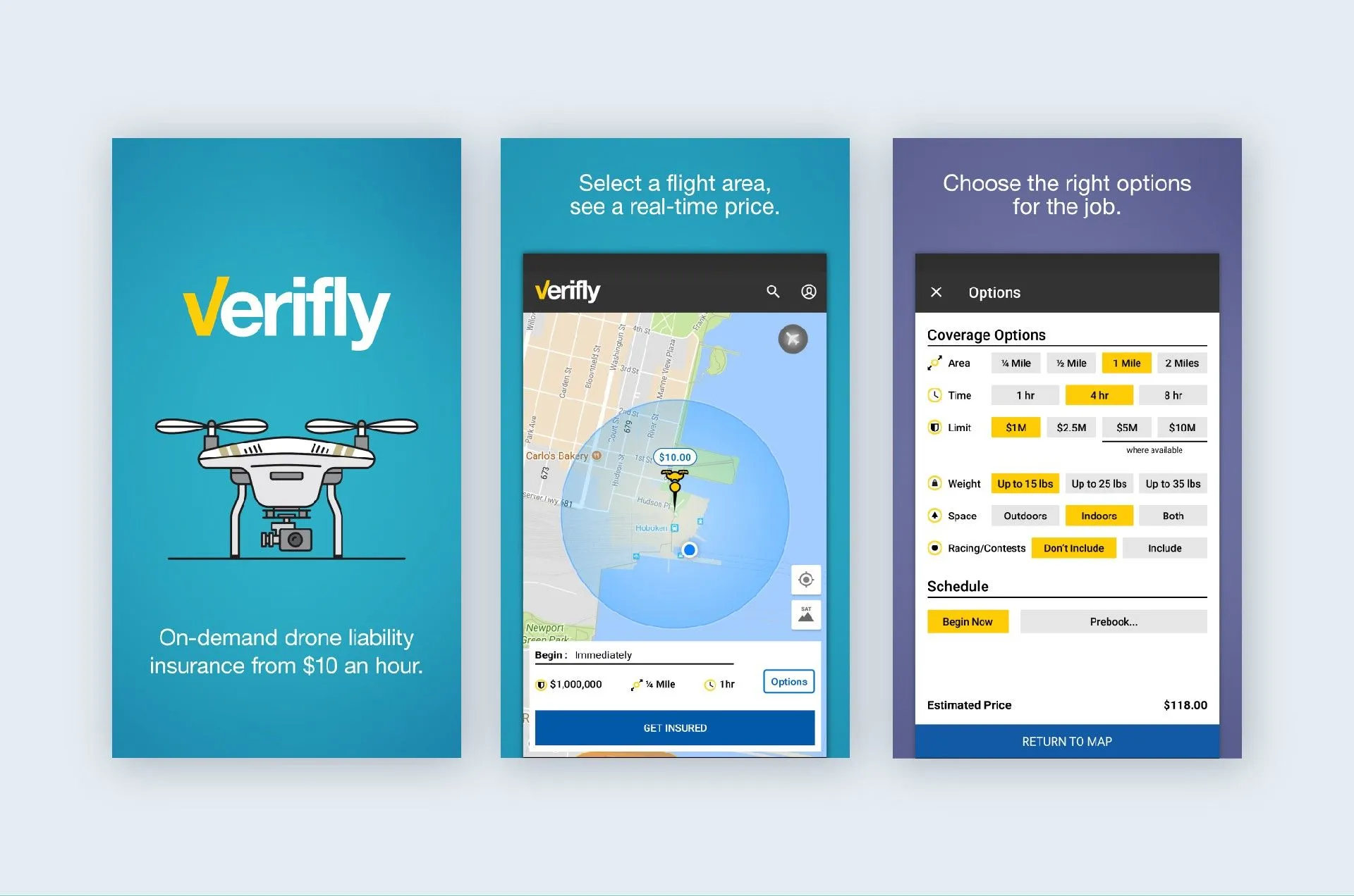
Verifly offers a user to select a flight area and then provides a real-time insurance price with coverage for up to 8 hours. Payments are made directly in the app. So if you are looking for an insurance estimator for some particular flights, Verifly will become your best choice.
SkyWatch AI Drone Insurance Pro
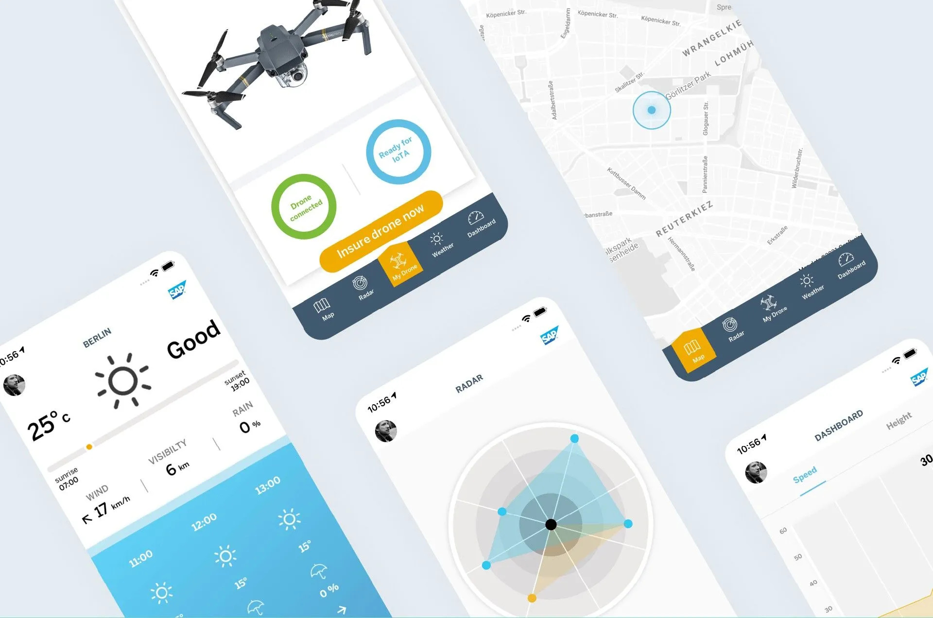
When it comes to SkyWatch.AI, there are three insurance plans that include liability and hull coverage: hourly, monthly, and annual. One of the best things about this app is that the insurance plans offered are fully customizable, so you pay only for the coverage you need, and when you need it. Because the app analyses each flight and calculates a safety score, a user can enjoy up to a 30% discount on the chosen insurance plan. But that’s not all: in addition to insurance, SkyWatch.AI offers pre-flight planning, real-time flight warnings, and post-flight summary features that allow you to become the best pilot.
The idea behind the solution developed by Emerline is the following: after the app is downloaded from the Apple store, a user opens it and sees several insurance options. Still, it’s not possible for a user to choose from these options before the test flight.
The test flight is aimed at estimating the piloting skills of a user, so, in accordance with the received and analyzed telemetry, terms of insurance are provided. Telemetry of the flight includes:
- Drone GPS coordinates (lat and long)
- Remote GPS coordinates (lat and long)
- Drone Speed, Distance, Altitude
- Flight mode
- Battery State
- Photo / Video capturing state
- Pitch, yaw, roll
- Date, Time and Timezone
After the test flight is over and the user purchases insurance, the app continues to gather telemetry and analyze it for the next insurance rate. Depending on the piloting skills of the user, the next insurance can come at a higher or lower price.
Considering the fact that, according to Statista, sales of US consumer drones to dealers surpassed $1.25 billion in 2020, and the forecast of Goldman Sachs stating that the total drone market size to be worth $100 billion, the demand for apps for drones will grow. So if you are interested in the development of a drone app and are looking for an experienced technology partner to provide you with such a solution, feel free to contact us at any time for a free consultation.
Published on Apr 2, 2023